Modelling
This section describes how to build models in Leapfrog Geo.
- Geological models can be built from lithology data or from any other suitable data in the project. Visualising data in the scene is an important step in determining the model that will be built, and the tools for doing this are described in Visualising Data. Once this has been determined, the next step is to define a basic geological model and refine its boundaries. Modelling contact surfaces and setting their cutting relationships determine how the basic model volume is divided into lithologies. Models can also have a fault system that, once activated, will subdivided the model into fault blocks.
- With the Numeric Models folder, you can interpolate downhole numeric data, composited drillhole data and points data.
- Combined models use information from up to four geological models, interpolants and distance functions in order to visualise relationships between different types of data in the project.
-
-
Evaluations
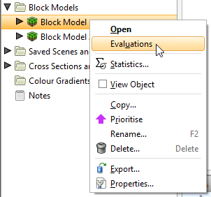
In Leapfrog Geo, models can be evaluated onto other objects in the project. To do this, right-click on an object and select Evaluations:
See Back-Flagging Drillhole Data for information on evaluating drillholes on geological models.
See Evaluating on Sections for information on evaluating surfaces on cross sections and fence sections.
See Evaluating Points Data for information on evaluating surfaces on points.
A window will appear listing all objects in the project that can be used for an evaluation. Once you have selected one or more objects, click OK.
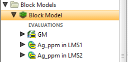
The evaluations will be added to the object in the project tree:
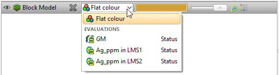
When you display objects in the scene, you can select the evaluations from the view list:
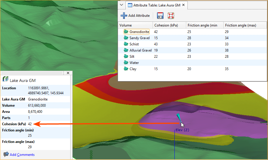
Assigning Attributes to Volumes
For geological models, numeric models and combined models, you can assign attributes to the model volumes. To do this, right-click on the model in the project tree and select Volume Attributes. In the window that appears, click the Add Attribute button to add a new column.
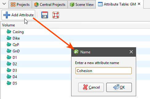
Enter a name for the column and click OK. You can then edit the values in the table. When you click in the scene, the values will be included in the information displayed about the selected volume:
Attribute information cannot be displayed in the Central Browser.
When you save scenes for viewing in Leapfrog Viewer, manually entered attributes will be displayed when volume information is displayed.
Got a question? Visit the My Leapfrog forums at https://forum.leapfrog3d.com/c/open-forum or technical support at http://www.leapfrog3d.com/contact/support